Troglodytus Design 3 years ago - September 11, 2021
Update - SWITZERLAND 20m DEM - High Resolution Terrain Elevation Data from LIDAR Imaging
Troglodytus has updated their release to version 1.3.
Since World Update the generic mesh data is really high quality However here is a short pro and con list for the use of this Addon br br CON br Default mesh is now higher quality when being very close to the ground mountains br br PRO br The mountains still look better from far away as the LOD scaling...

SWITZERLAND 20m DEM - High Resolution Terrain Elevation Data from LIDAR Imaging
SWITZERLAND 20m DEM - High Resolution Terrain Elevation Data from LIDAR Imaging is a Microsoft Flight Simulator mod created by Troglodytus. It has been released 28 April 2024 and downloaded 17.5K times since.
Troglodytus Design 3 years ago - September 11, 2021
Update - AUSTRIA 20m DEM - High Resolution Terrain Elevation Data from LIDAR Imaging
Troglodytus has updated their release to version 1.2.
Since World Update the generic mesh data is really high quality However here is a short pro and con list for the use of this Addon br br CON br Default mesh is now higher quality when being very close to the ground mountains br br PRO br The mountains still look better from far away as the LOD scaling...

AUSTRIA 20m DEM - High Resolution Terrain Elevation Data from LIDAR Imaging
AUSTRIA 20m DEM - High Resolution Terrain Elevation Data from LIDAR Imaging is a Microsoft Flight Simulator mod created by Troglodytus. It has been released 28 April 2024 and downloaded 5.1K times since.
Troglodytus Design 3 years ago - September 11, 2021
Update - GERMAN ALPS 20m DEM - High Resolution Terrain Elevation Data from LIDAR Imaging
Troglodytus has updated their release to version 1.2.
Since World Update the generic mesh data is really high quality However here is a short pro and con list for the use of this Addon br br CON br Default mesh is now higher quality when being very close to the ground mountains br br PRO br The mountains still look better from far away as the LOD scaling...
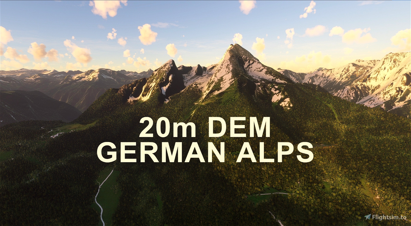
GERMAN ALPS 20m DEM - High Resolution Terrain Elevation Data from LIDAR Imaging
GERMAN ALPS 20m DEM - High Resolution Terrain Elevation Data from LIDAR Imaging is a Microsoft Flight Simulator mod created by Troglodytus. It has been released 28 April 2024 and downloaded 10.8K times since.
Troglodytus Design 3 years ago - September 02, 2021
Update - [EDMV] - Vilshofen Airport, Germany
Troglodytus has updated their release to version 1.1.
changes v br br Corrected misaligned runway start br Reduced the bumpiness within the runway profile - Users reported slightly overexaggerated bumps in the runway compared to real life It seems as if the DEM mesh used was not perfect br corrected slightly tilted threshold arrows br corrected height and profile of nearby roads for further realism br Added loads...
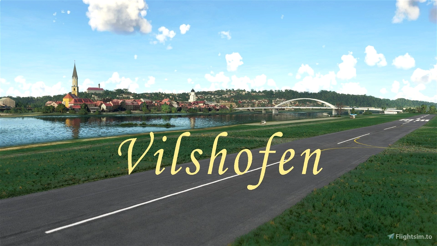
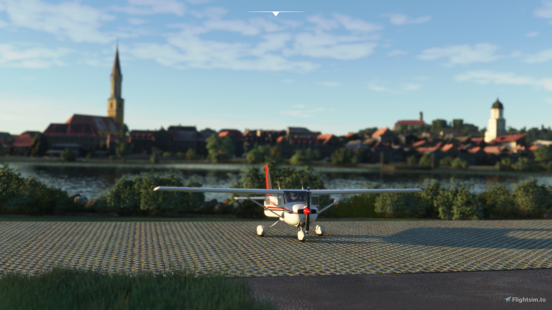
[EDMV] - Vilshofen Airport, Germany
[EDMV] - Vilshofen Airport, Germany is a Microsoft Flight Simulator mod created by Troglodytus. It has been released 28 April 2024 and downloaded 4.7K times since.
Troglodytus Design 3 years ago - September 01, 2021
Release - [EDMV] - Vilshofen Airport, Germany
Troglodytus has uploaded a new file.
[EDMV] - Vilshofen Airport, Germany
[EDMV] - Vilshofen Airport, Germany is a Microsoft Flight Simulator mod created by Troglodytus. It has been released 28 April 2024 and downloaded 4.7K times since.