PlaneGuy04 3 years ago - June 11, 2021
Update - British Columbia, 15m DEM - High Resolution Terrain Elevation Data from LIDAR Imaging Part 1
PlaneGuy04 has updated their release to version 1.2.
reduced the size of the vancouver exclusion zone to reduce chances of conflicts. Only the part 1 file needs to be redownloaded.

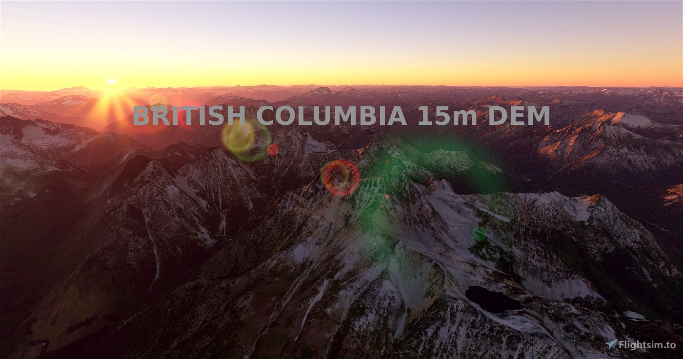
British Columbia, 15m DEM - High Resolution Terrain Elevation Data from LIDAR Imaging Part 1
British Columbia, 15m DEM - High Resolution Terrain Elevation Data from LIDAR Imaging Part 1 is a Microsoft Flight Simulator mod created by PlaneGuy04. It has been released 22 May 2024 and downloaded 5.3K times since.
PlaneGuy04 3 years ago - June 08, 2021
Update - Vancouver Island, Canada, 15m DEM - High Resolution Terrain Elevation Data from LIDAR Imaging
PlaneGuy04 has updated their release to version 1.2.
Excluded city of Victoria after reports of missing photogrammetry (only south and full files updated)
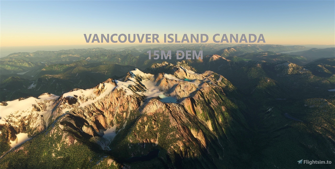
Vancouver Island, Canada, 15m DEM - High Resolution Terrain Elevation Data from LIDAR Imaging
Vancouver Island, Canada, 15m DEM - High Resolution Terrain Elevation Data from LIDAR Imaging is a Microsoft Flight Simulator mod created by PlaneGuy04. It has been released 22 May 2024 and downloaded 6.6K times since.
PlaneGuy04 3 years ago - June 08, 2021
Update - British Columbia, 15m DEM - High Resolution Terrain Elevation Data from LIDAR Imaging Part 1
PlaneGuy04 has updated their release to version 1.1.
Excluded city of Vancouver after reports of missing photogrammetry (only need to redownload main file)
British Columbia, 15m DEM - High Resolution Terrain Elevation Data from LIDAR Imaging Part 1
British Columbia, 15m DEM - High Resolution Terrain Elevation Data from LIDAR Imaging Part 1 is a Microsoft Flight Simulator mod created by PlaneGuy04. It has been released 22 May 2024 and downloaded 5.3K times since.
PlaneGuy04 3 years ago - June 06, 2021
Release - British Columbia, 15m DEM - High Resolution Terrain Elevation Data from LIDAR Imaging Part 2
PlaneGuy04 has uploaded a new file.
British Columbia, 15m DEM - High Resolution Terrain Elevation Data from LIDAR Imaging Part 2
British Columbia, 15m DEM - High Resolution Terrain Elevation Data from LIDAR Imaging Part 2 is a Microsoft Flight Simulator mod created by PlaneGuy04. It has been released 22 May 2024 and downloaded 3.5K times since.
PlaneGuy04 3 years ago - June 06, 2021
Release - British Columbia, 15m DEM - High Resolution Terrain Elevation Data from LIDAR Imaging Part 1
PlaneGuy04 has uploaded a new file.
British Columbia, 15m DEM - High Resolution Terrain Elevation Data from LIDAR Imaging Part 1
British Columbia, 15m DEM - High Resolution Terrain Elevation Data from LIDAR Imaging Part 1 is a Microsoft Flight Simulator mod created by PlaneGuy04. It has been released 22 May 2024 and downloaded 5.3K times since.
PlaneGuy04 3 years ago - May 27, 2021
Update - Vancouver Island, Canada, 15m DEM - High Resolution Terrain Elevation Data from LIDAR Imaging
PlaneGuy04 has updated their release to version 1.1.
fixed elevation around 2 airports
investigated white spots in water around island - no issue
Vancouver Island, Canada, 15m DEM - High Resolution Terrain Elevation Data from LIDAR Imaging
Vancouver Island, Canada, 15m DEM - High Resolution Terrain Elevation Data from LIDAR Imaging is a Microsoft Flight Simulator mod created by PlaneGuy04. It has been released 22 May 2024 and downloaded 6.6K times since.