
Welcome to Queenstown, Tasmania
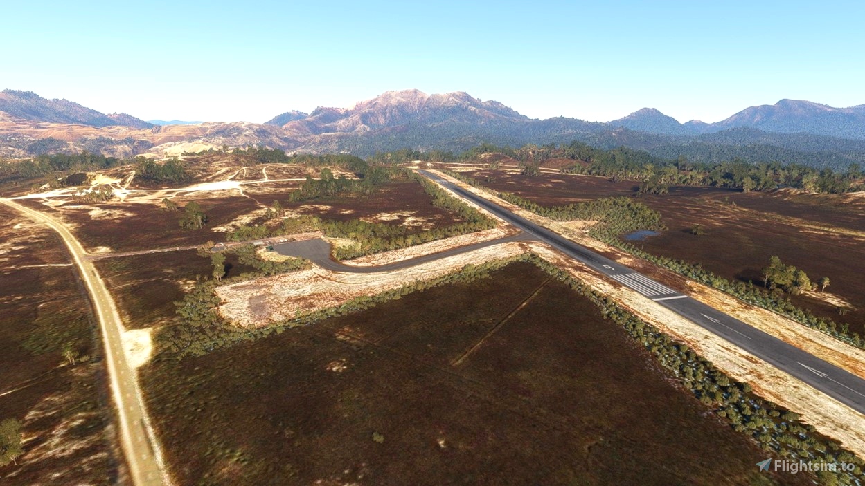
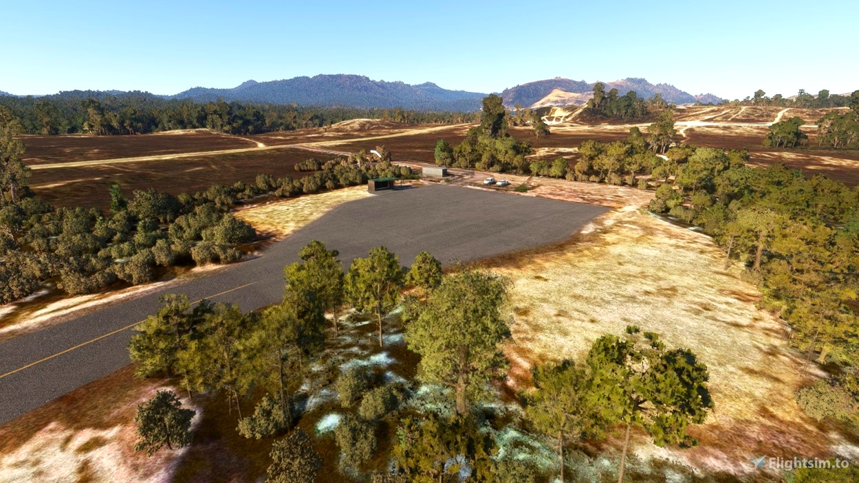
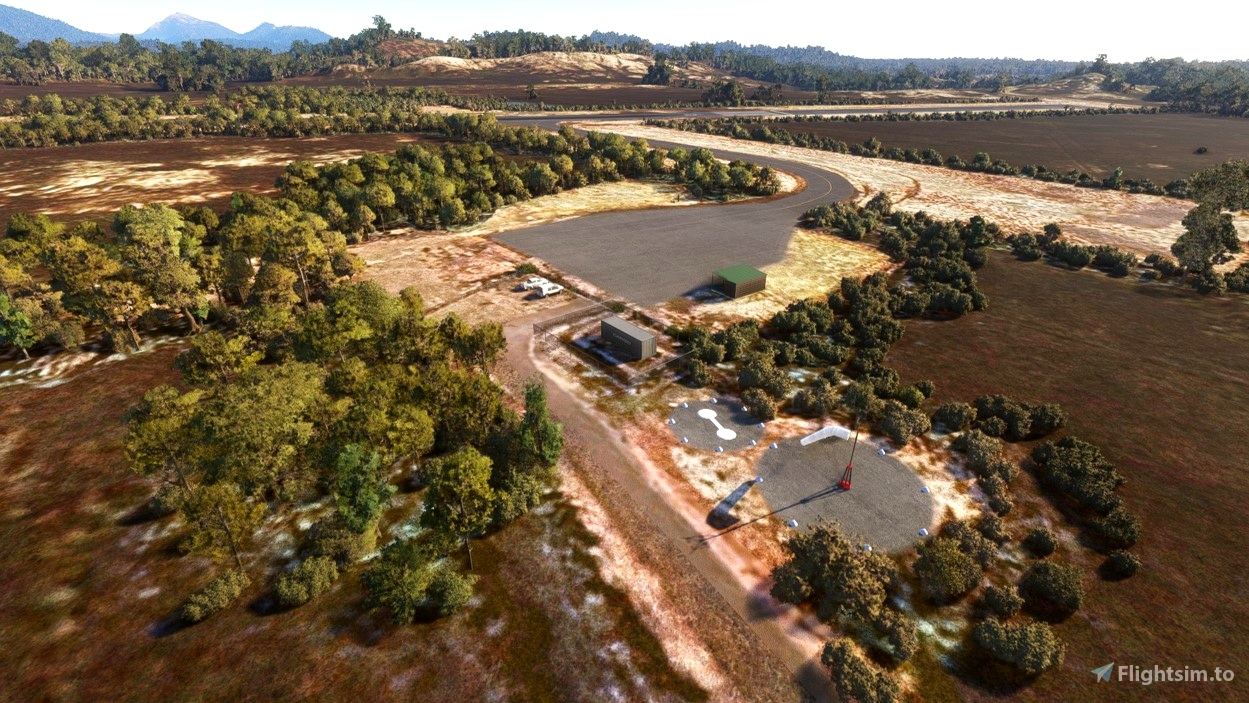
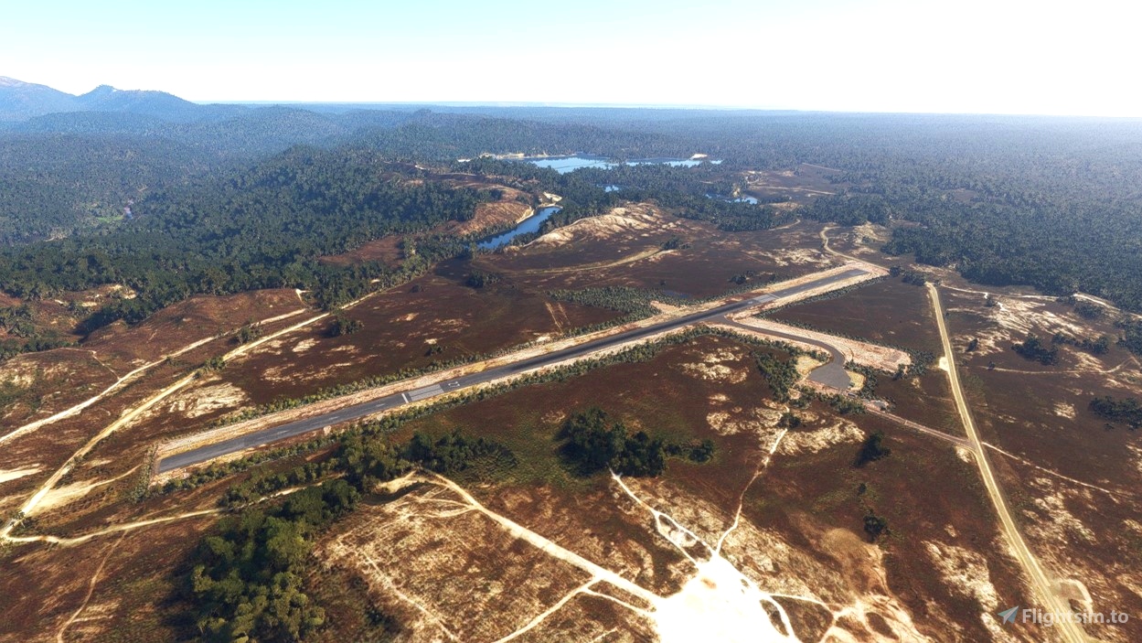
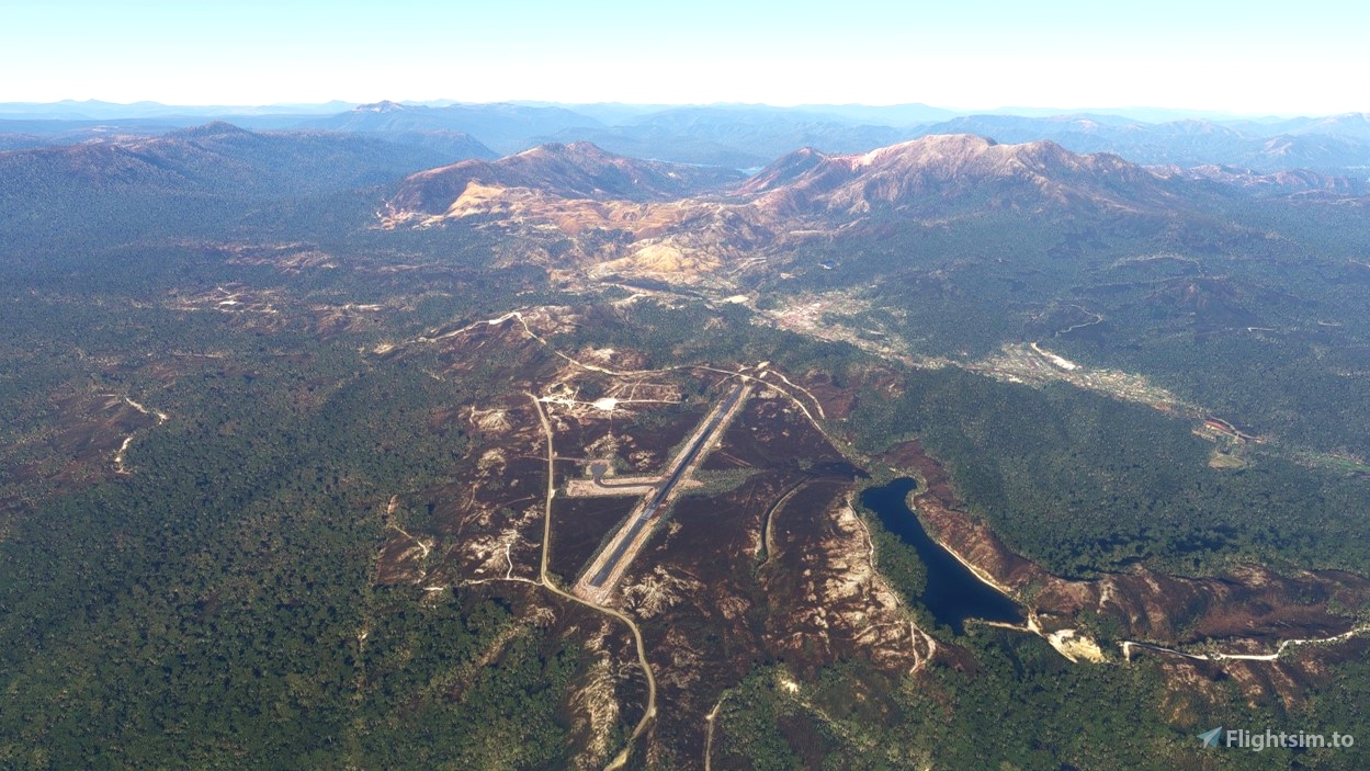
Welcome to Tasmania's wild west coast region. Queenstown Airport is located at Howards Plains 2km west of Queenstown, overlooking Mt Lyell and Mt Owen. The airstrip has a 1200m asphalt runway and a small associated apron area. This airstrip was constructed in the 1930s with regular passenger services until at least 1993. However, it is now disused but still maintained by the local council with permission required for all landings.
This package includes scenery for the airstrip and improved aerial imagery sourced from Google Earth. There is also my first attempt at bringing custom models into the sim with a custom shelter area I modelled based on the limited reference imagery available.
Thanks for downloading! If you find any issues or have requests/suggestions for future sceneries, feel free to get in touch.
Dependencies
MSFS 2020 object library 200+ models - towers hangars to cones v14-10 UPDATE
See Also From SC Sceneries
YDAR Darlington (Maria Island)
Credits
Google Earth imagery is provided for non-commercial recreational use as stated in Google's guidelines.
- Imagery @ 2023 Airbus, CNES / Airbus Technologies
