


AS33me
VIAW to VIKL
All credits to @B21 / MSGamerTag01 for this task.
MSFS Local date & time is November 15, 02:00 PM
Max start: 9000 Feet MSL
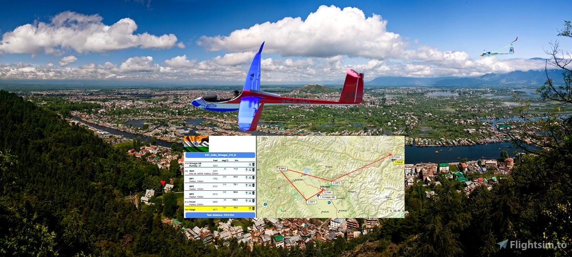
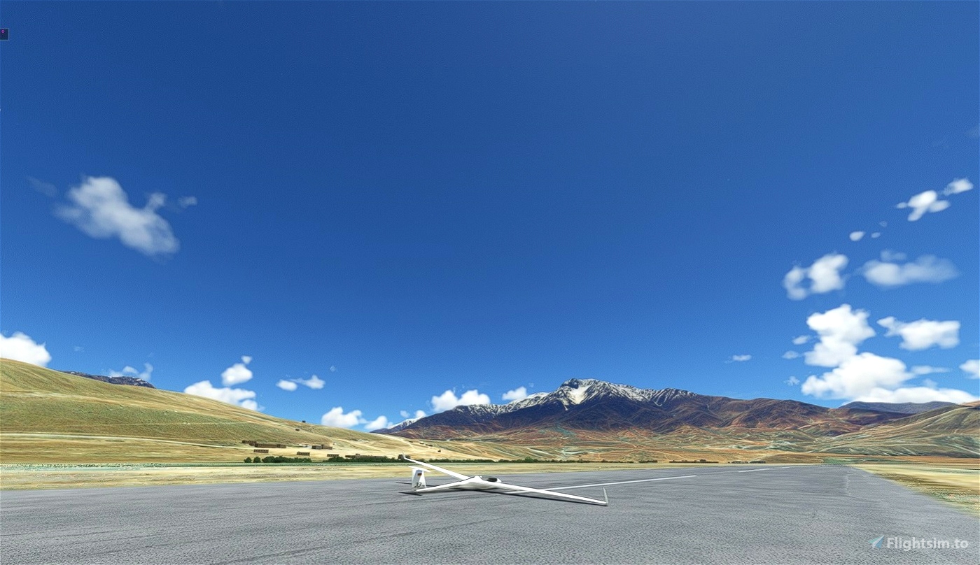
You will depart from VISR Srinagar AB (Rwy 31)
You will land at VIKL Kargil
Soaring Type is Ridge, Thermal
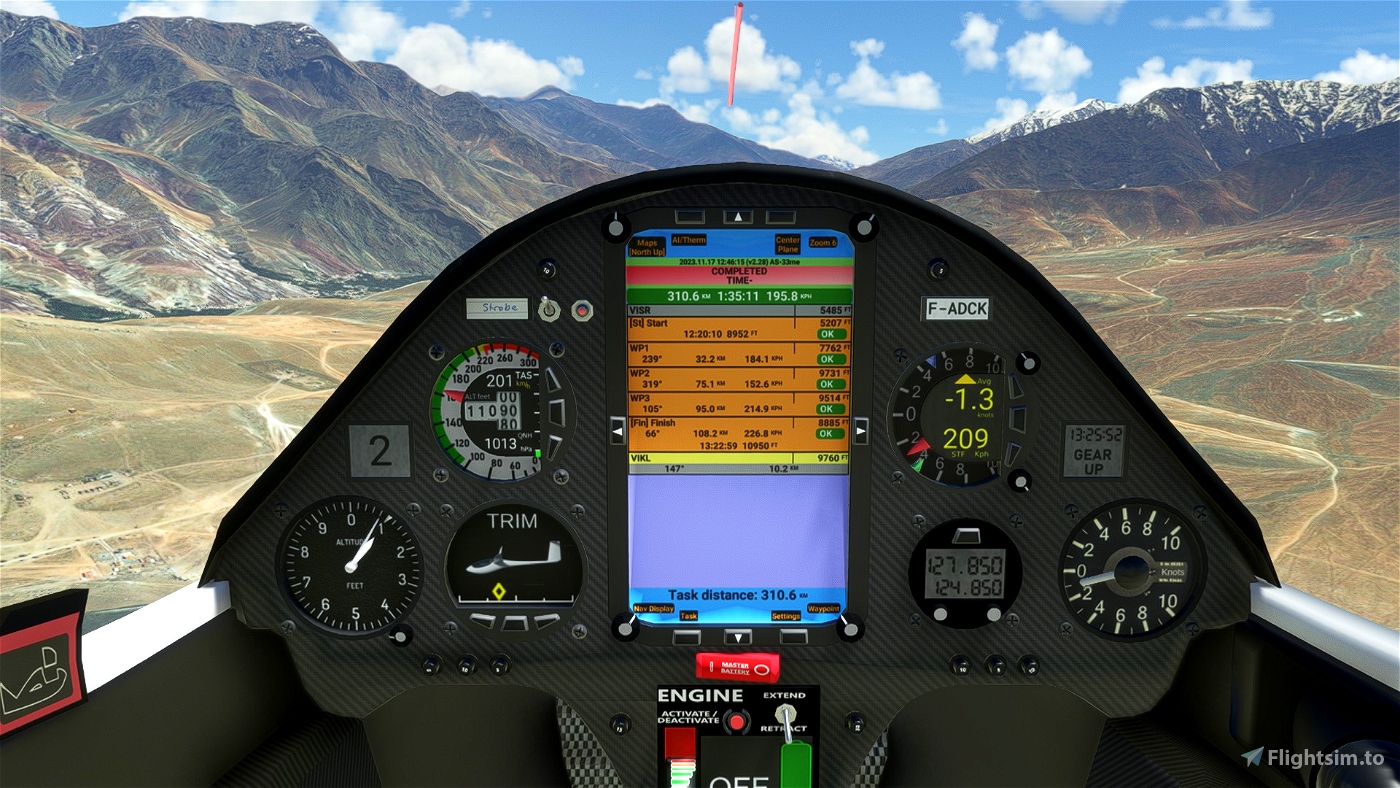
Distance are 332 km total (311 km task)
Approx. duration should be 90 to 180 minutes (1h30 to 3h)
Recommended gliders: Flapped
The difficulty is rated as Experimented
The weather profile to load is SSC Soaring Weather N
The elevation measurement used is AGL (Above Ground Level)
The barometric pressure is 29,92 inHg
The temperature is 24°C
The humidity index is 3,00
Wind Layers
- Ground 0° @ 12,5 kts (raising to 25 kts around 1000')
- 1640' 0° @ 4 kts
- 1969' 0° @ 4 kts
- 6562' 0° @ 6 kts
- 19685' 0° @ 1 kts
Cloud Layers
- From 6562' to 19685', 10% coverage, 1,000 density, 64% scattering
- From 28569' to 30684', 42% coverage, 0,000 density, 35% scattering
A local ridge will provide enough height for the start.
The first leg crosses the valley to WP1 and you'll want to ensure you arrive there with enough height to pick up any ridge lift and progress NW where the ridges will improve towards WP2.
Then WP3 is straightforward to reach as you plan when to leave the ridges nearer WP2 for an arrival height at WP3 you're happy with.
Then it's an uphill glide along the winding valley to the Finish.
1 Srinagar AB VISR 5453 ft
2 Start 9000 ft maxi
3 WP1 7762 ft
4 WP2 9731 ft
5 WP3 9514 ft
6 Finish 8885 ft
7 Kargil VIKL 9571 ft
MADoloSimulations B21
https://fr.flightsim.to/file/15090/as-33-me
SCC Sim Soaring Club
https://www.instagram.com/simsoaringclub/
https://discord.me/simsoaringclub
.

 ADCKillerman

