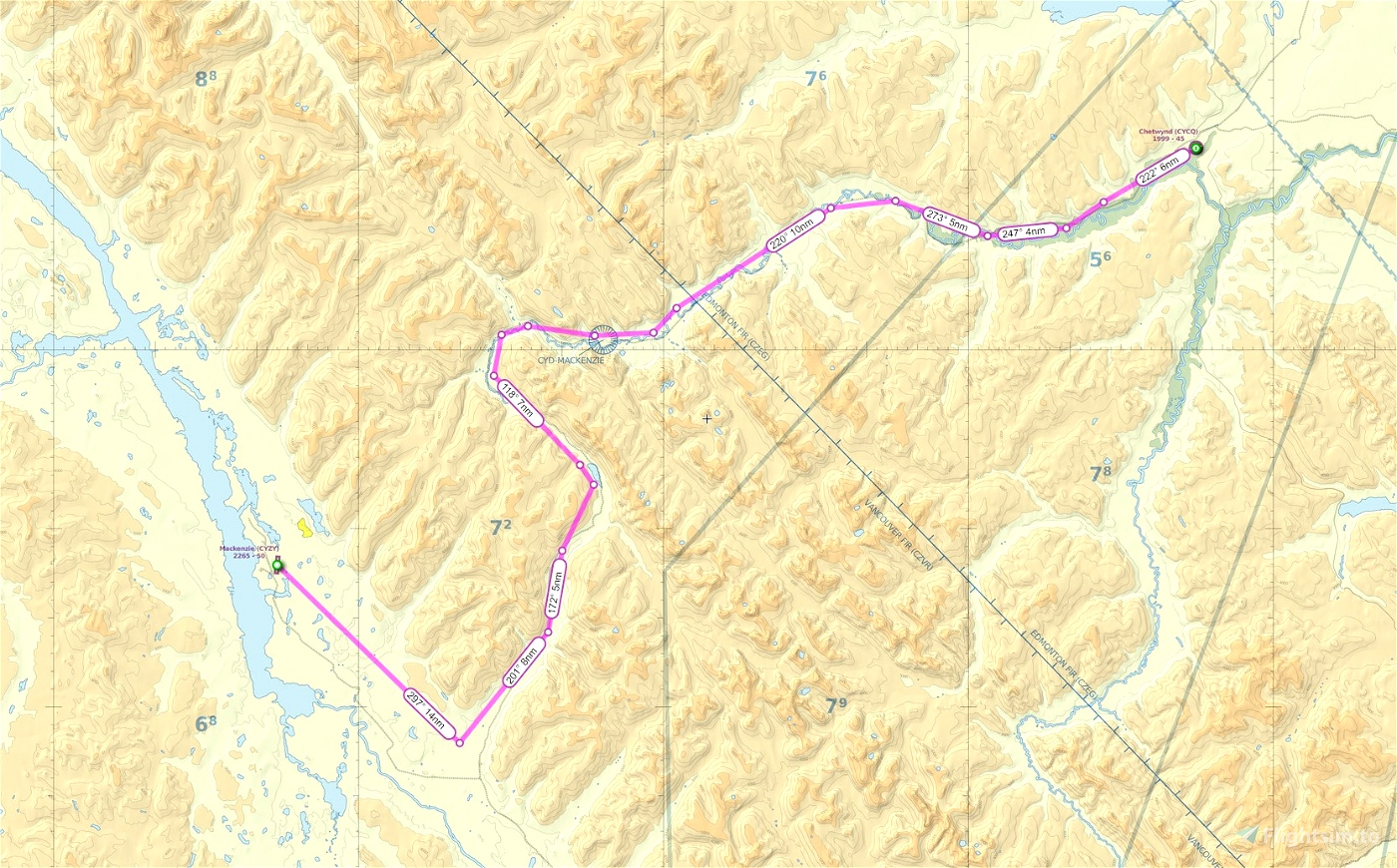
This is a GPS flightplan route from Chetwynd BC CYCQ to Mackenzie BC CYZY using the published VFR route on the VNC chart. The trip takes you through the notorious Pine Pass. (If you've ever driven this in the winter time you'll know what I mean.)
Flight distance 87 nm.
Minimum enroute altitude 6500 feet.
Reverse route is included...
Note: there is an ASOBO issue that if you load in the flight plan then change your departure runway, it will revert to a straight line route. Best practice is to always start from a parking spot.
Cheers!

 deltasim59er

