Navigraph VFR Charts Released and Pricing Changes

After announcing last week that the next big update for the popular Navigraph Charts would come this week, Navigraph has followed up with a post earlier today announcing the release of Navigraph Charts 8, announcing pricing changes, and renaming subscriptions.
VFR Charts
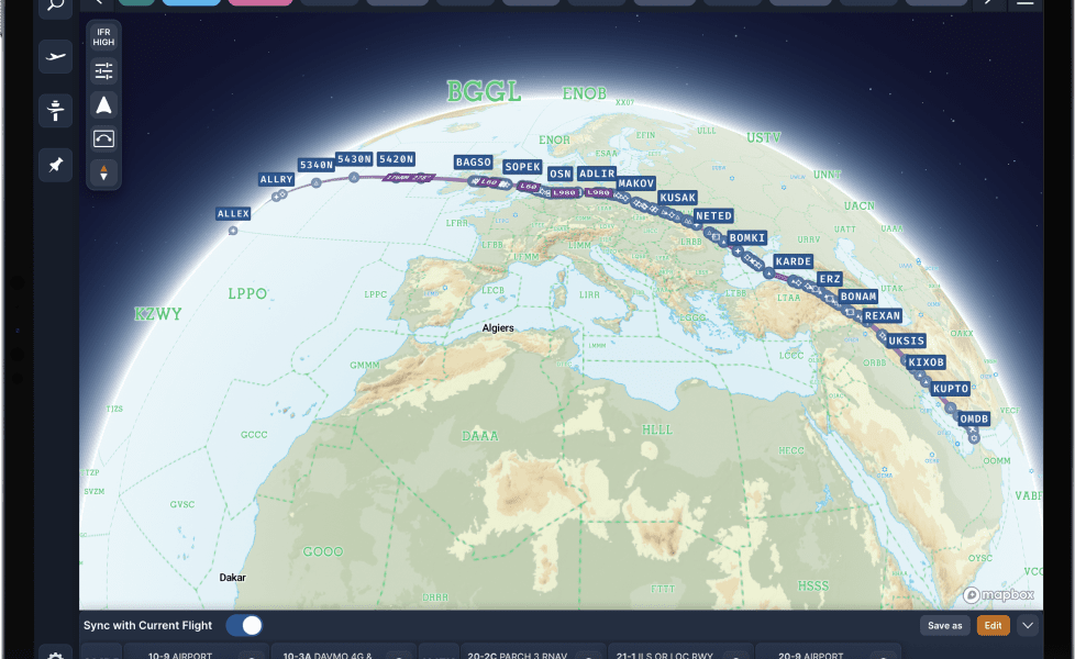
Navigraph Charts 8 come with worldwide VFR charts, drag and drop route construction as well as global airport crosswind and weather information. What’s more, the new version also is able to project your route on a 3D globe inside the application and automatically pin important charts for the route to the top.
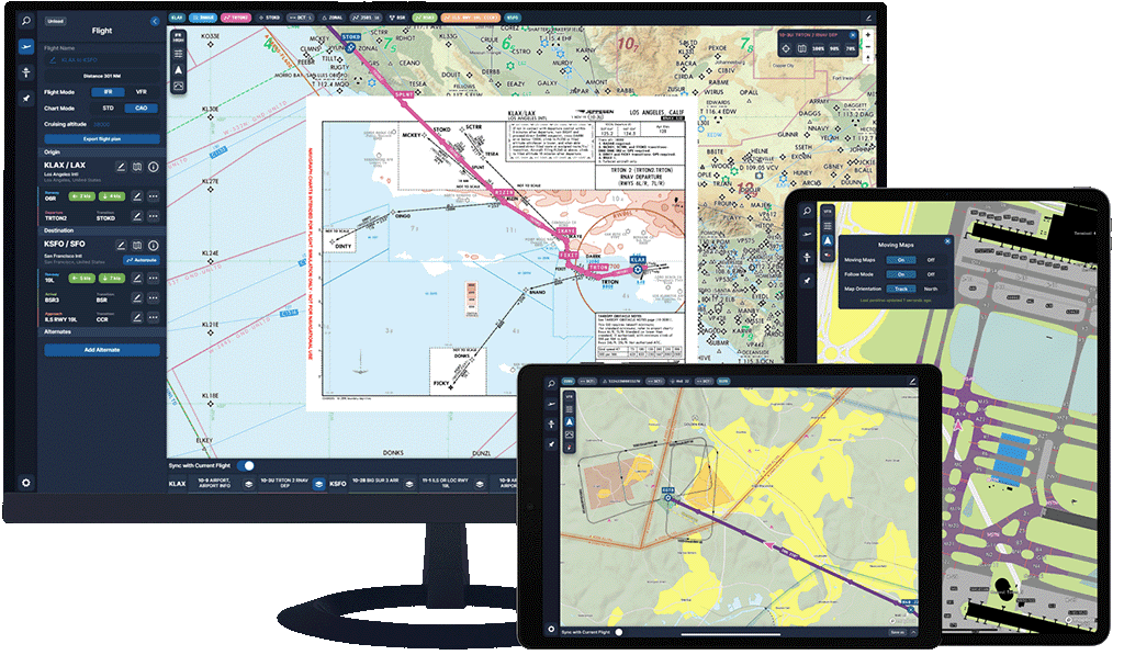
The VFR charts allow flight simmers to display an interactive map with visual reporting points, entry and exit routes, traffic patterns, transition routes, and flyways. Optionally, flight simmers can also set to show water bodies, roads, railroads, powerlines, churches, landmarks, obstacles, highpoints, and other points that might help you navigate on your VFR path.
The charts now also clearly mark airspaces, populated areas, and avoid-overflying zones in addition to minimum off-route altitudes. In other words, everything you’ll need to successfully complete a VFR flight. In the future, Navigraphs wants to implement weather layers on the map, traffic visualization from popular networks, navlogs to keep track of past flights, or chart annotations to take taxi instructions on the charts.
Pricing changes
Starting from December 8th, 2022, Navigraph will be increasing the prices of their products due to increased costs for product development, data licensing, and significant inflation. The new prices will be following:
- Navigraph Unlimited (Ultimate) Monthly – 9.05€
- Navigraph Unlimited (Ultimate) Yearly – 81.64€
- Yearly Navigation Data – 29.79€
The price adjustment will apply to both new and active subscriptions. You can subscribe to Navigraph through their website for 8.3€ per month, or 75€ per year, for the Unlimited package.
FSNews is your one-stop source for news, reviews, and editorials related to flight sims.