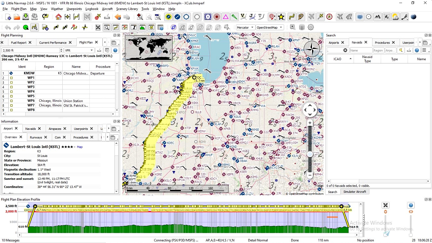

Illinois is the first Leg of a journey that will follow historic Route 66 from beginning to end. You'll start your flight at Chicago Midway (KMDW) and fly northwest towards Lake Michigan, WP1 will be Soldier Field, WP2 is the Navy Pier then west into downtown Chicago where WPT3 East Illinois Street, will be the start of Historic Rt66.
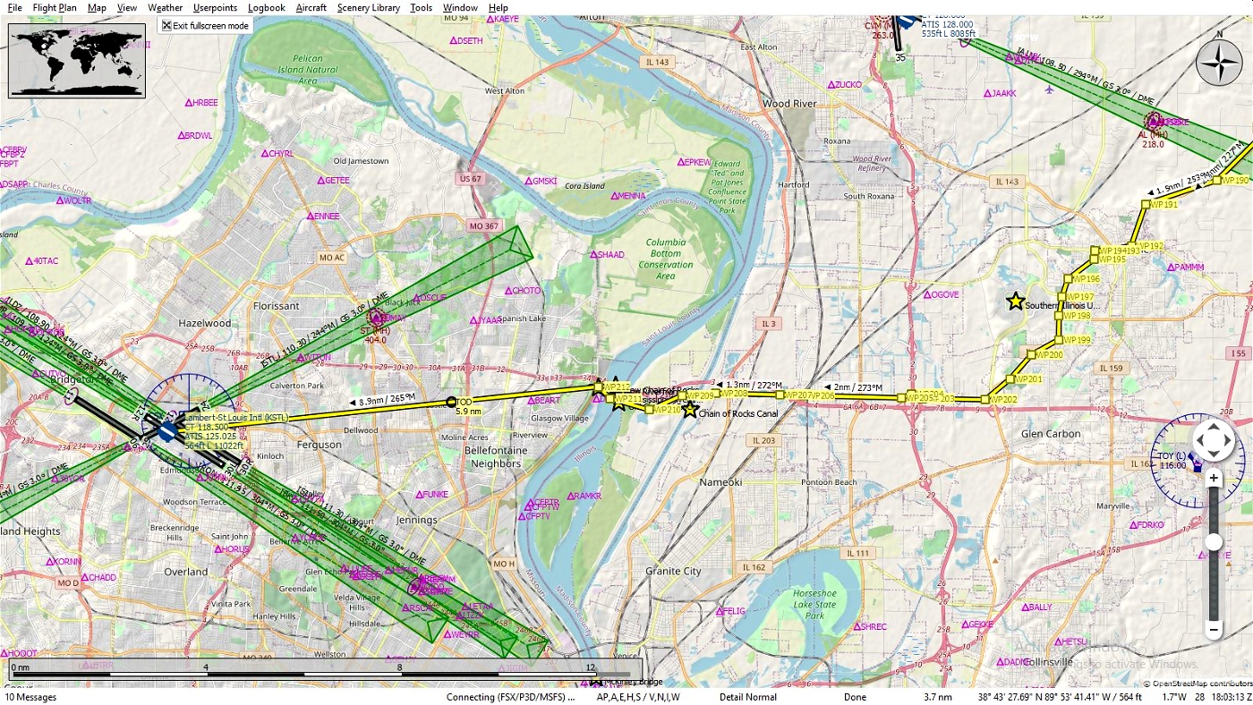
Outside the cities you'll fly over miles of farmland, quarries, lakes and rivers. There are many airports along the route, some have fuel while others are for private plane owners and crop dusters. You'll end your trip through Illinois flying over the Mississippi River via the Old Chain of Rocks Bridge built in 1929 which is now closed and only open to foot/bike traffic, but that won't concern you of course. The bridge to the north is the New Chain of Rocks Bridge. Once in Missouri you'll land at Lambert-St. Louis Intl. (KSTL), when the Missouri Leg is released you'll have to fly back to the old bridge about 9 miles then make your way south along the Mississippi into downtown St. Louis to continue your journey.
Route 66 isn't or wasn't a single road from end to end but was rerouted in certain areas over the years for various reasons. I wish I could add POI's to point out various historic sights which there are many along the route. The flight plan was created using LittleNavmap and I have marked sights in hopes that one day I can edit and combine the route with special POI's, until then you can follow your journey using LittleNavmap or another program that shows what is in a particular area.
TIPS: It's suggested to fly low and slow since your following a route intended for automobiles. It will naturally twist and wind it's way through towns large and small so don't be to concerned about hitting each way point exactly, the idea is to follow the overall route and not take each and every turn, unless that's just your thing.
Plan on doing the entire trip from Chicago to St. Louis, trust me, if you save the flight while your flying and want to resume later you can, only you won't have any way points to follow since it only loads the flight where you left off and that's it! The Illinois leg is 266 NM, 66 imagine that, and can be finished in a couple of hours depending on which aircraft you choose and how you like to fly, fast, slow, in circles etc.
Along the way you may encounter some terrain anomalies, this isn't caused by this file but the sim itself. You may wish to try and use Elevation Fixes - United States by Alpine Scenery found on this site. It corrects not only those you may see here but in your other flights as well.
INSTALATION: It's entirely up to you how you want, here are two possible ways.
Open the zip file and drag the ".pln" file into your "LocalState" folder within your MSFS2020 installation. That's where the sim keeps all your saved flights. Open MSFS2020 go to the world map, choose your aircraft and settings then load the flight plan and fly.
If you use Little Navmap, unzip the file to a temporary location then load the ".pln" file into Little Navmap and use the "Export Flight Plan as MSFS 2020 PLN" to export it into the sim, you can name this file anything you wish just so you will know exactly what file you want to load and not mix it up with another flight you may have saved. Then open MSFS2020 go to the world map, choose your aircraft and settings then load the flight plan and fly. Sounds more complicated then it really is this is the method I prefer since, as mentioned above, you can follow your flight and pause it anytime you see something interesting you want to know about such as a park, a mine etc. and hopefully it will be identified on the map. You can also edit your flight and save as it to whatever you want to call it, land at a certain airport, take a side trip to see your aunts house, it's your world have fun.
LINKS: Little Navemap
Historic Route 66 Turn by Turn - Illinois
This is where most of the flight plans and future ones used are from. It's also a great site to keep open and pause your flight now and then if you want to follow along, learn about some of the sights and why the route went the way it did and why some parts of Rt 66 were changed from the original. Of course this could make your two hour excursion turn into an all day odyssey!
Elevation Fixes - United States by Alpine Scenery A world wide version is also available to download.
Get Your Kicks Above Route 66 Series:
#1 Illinois
#2 Missouri & Kansas
#3 Oklahoma
#4 Texas
#5 New Mexico
#6 Arizona
STATS:
266 NM
212 waypoints
Enjoy your flight and get your kicks above Route 66!

 SearchN


I actually hand flew the entire Route 66 VFR without a flight plan. I began my journey at Chicago Meigs Field. I had to keep a visual on the road/map. Still it was an absolute blast. Only had to make one unscheduled landing due to weather in NM I believe. Now I will do it again VNAV! Thanks
2 years ago
Great Job! Good to hear you had fun flying the route and intend to continue with it. Happy landings!
2 years ago
SearchN
Nico1987
I am interested in this idea you have started. I have actually driven several legs of this route, but mostly out West. Any plans to continue the journey? Never mind. I just saw all of your additions.
2 years ago
Hope you enjoy it thanks for downloading it.
2 years ago
SearchN
MadMac388th
3 years ago
SearchN
3 years ago
SearchN
3 years ago
SearchN
3 years ago
3 years ago
SearchN
g4kfj
3 years ago
SearchN
3 years ago
3 years ago
SearchN
Channel76
3 years ago
3 years ago
SearchN
celeritas670