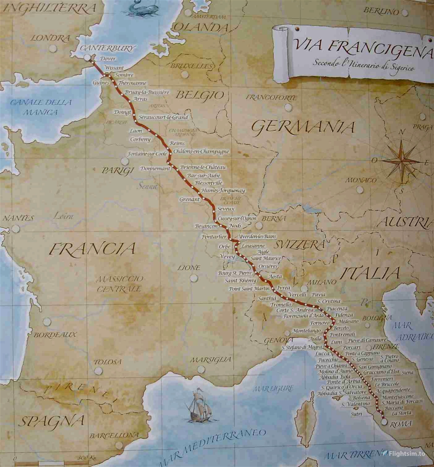
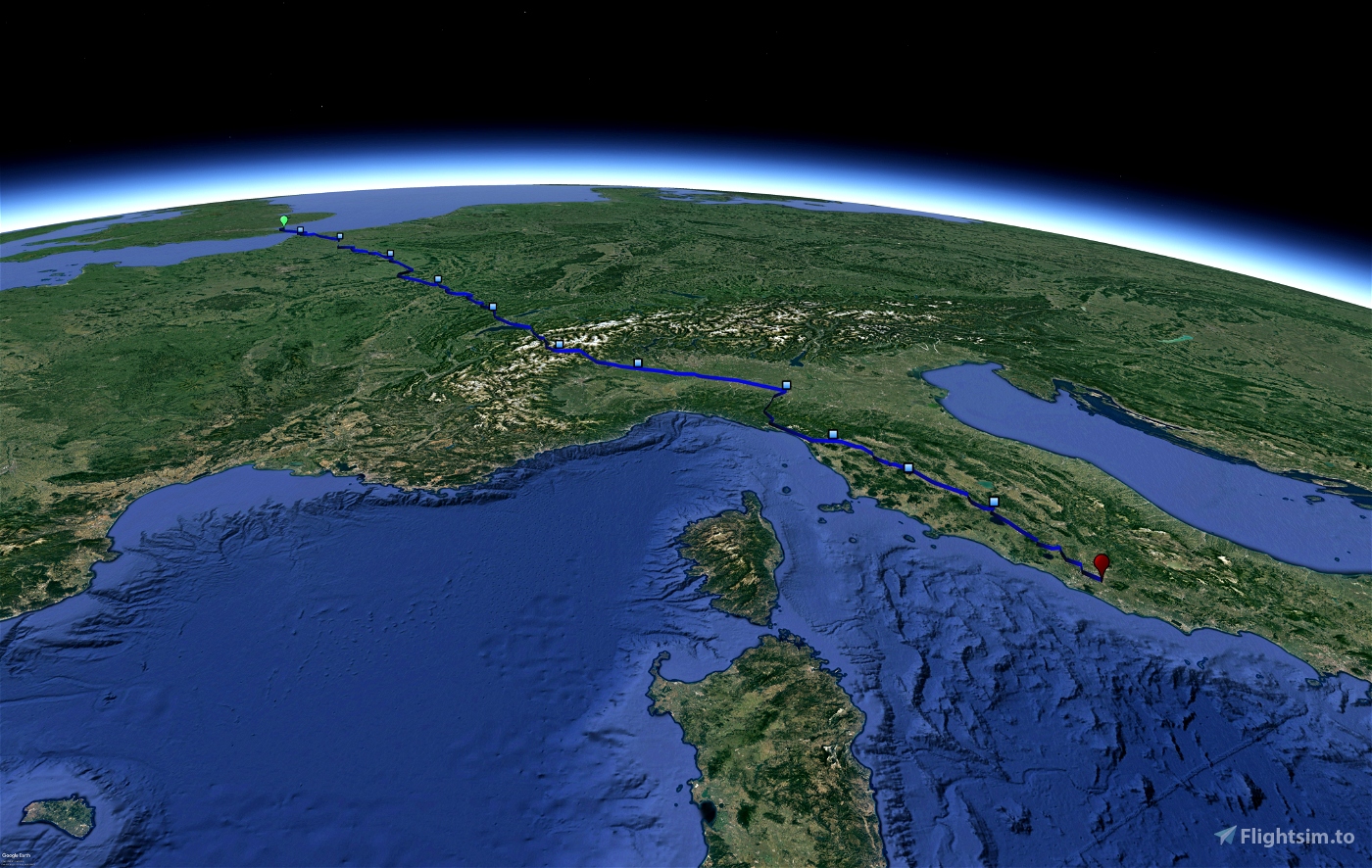
This bush trip follows the path of the Via Francigena from Canterbury to Rome. You will fly from England, cross the France in a North - East diagonal, cross Switzerland from North to South, and go to the center of Italy.
The navlog was thought in order to be able to follow the route without referring to precise heading and ETE. So there are precise descriptions of the path to follow and relatively shorts distance between waypoints (an average of about 2 or 3 minutes). However some waypoints are difficult to reach without referring ETE and a precise heading.
I made the bushtrip in order to fly just over the cities on the route of the Via Francigena, so the track is tightly connected to the hicking trail.
There are 12 legs, with ETE from 50 to 100 nm, with an ETE of about 20 to 45 minutes.
The bushtrip is available in 15 languages thanks to DeepL translator.
Two files are available for the download, the main one where the plane is the Cessna Skyhawk, the second where the plane is the Beechcraft V35 Bonanza (Payware). A suited cruise speed for this bushtrip is 150 knots.
You will fly over many cities and landscapes, so some useful sceneries can be in :
- In France :
- Arras
- Besançon
- Calais
- Notre-Dame de Lorette
- St-Quentin
- Peronne
- In Italia
- Pavia
- Aosta
- Lucca (you should download it)
- Monteriggioni
- Piacenza
- San Gimignano
- Siena (realy necessary)
- Viterbo
Airports where you land are , and could download sceneries if they exist :
- EGHB
- LFIS (you should download it since the creator make also coastline tree removal)
- LFQD
- LFQA
- LFSU
- LFSP
- LIMW
- LILI
- LIMP
- LIQL
- LIQS
- LIIQ
- LIRA
The bushtrip was created with bushtrip injector, a very good tool for this with a very reacting community on its Discord.

 YBau
YBau 


Comment l’installe t on sur la sim merci
1 years ago
Bonjour,
Vous téléchargez le fichier. Ensuite vous le dézippez à l'aide de 7-zip (logiciel gratuit: https://www.7-zip.fr/) en faisant clic droit sur le fichier >> afficher plus d'options >> 7-zip >> extraire ici.
Déplacez ensuite le dossier ainsi obtenu vers votre "community folder".
Vous pourrez trouver ici un site qui explique où trouver ce fichier en fonction de votre installation de MSFS20 : https://support.justflight.com/support/solutions/articles/17000113722-where-is-the-community-folder-msfs2020
En démarrant le jeu, vous trouverez le bushtrip dans la section activités > activités personnalisées (custom activities)
Bon vol !
1 years ago
YBau
jeanluc09
Some promotion. Maybe that pilots want to fly an older bush trip too.
https://flightsim.to/file/8360/via-francigena
Siegeric would be very proud with all attention. I wish YBau much success with this trip.
Frontech
1 years ago
Frontech
Can i fly it with an Helicopter ?
1 years ago
It is clearly stated in the description: "Two files are available for the download, the main one where the plane is the Cessna Skyhawk, the second where the plane is the Beechcraft V35 Bonanza (Payware)."
1 years ago
Gerardius
Ritchy61